Porthcawl

Welcome to NCI Porthcawl

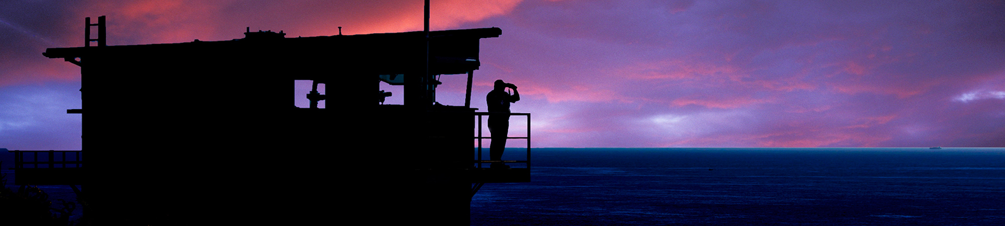
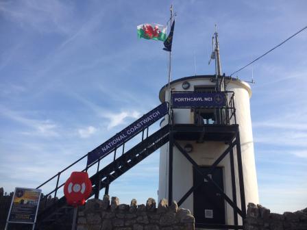
Situated in the South Wales coastal resort of Porthcawl at the eastern end of the Esplanade, Porthcawl National Coastwatch Station is located in the old Victorian Pilot Lookout Tower built in 1870, and is a Grade 2 listed building, adjacent to the RNLI Station. We overlook the Bristol Channel almost opposite Lynton and Lynmouth in North Devon, some 15+ miles away. Our field of view stretches east up to Nash Point on the Welsh side of the Channel, over to Minehead and down to Ilfracombe in the west. The lookout has been refurbished with grant funding from the Townscape Heritage Initiative, by Bridgend County Borough Council and the full support of Porthcawl Town Council. The lookout was in use during both the First and Second World Wars and has been used for various activities between those conflicts up until the 1960’s.

Porthcawl is a popular destination all year round, with visitors from all over the world for the surfing and the ‘Elvis’ Festival. The harbour has recently been refurbished with lock gates and moorings for some 70 boats, ensuring an increase in marine traffic. There are also several beaches in view of the lookout. The increase in coastal leisure users from swimmers, surfers, kitesurfers, walkers and fishermen, plus the high tidal ranges in the Bristol Channel, means that the maritime rescue and emergency services are kept busy.

Visitor Policy
The station is open every day and visitors are generally very welcome. However, when there is a watch handover or an incident is on-going this may not be convenient and the duty watchkeepers may ask that visitors call back later. You may even see a lifeboat launch and recovery at this time, from just behind the lookout.
Access

Access to the lookout is via the Esplanade. With a plentiful mix of free and paid parking, coffee shops, restaurants and other amenities and the Town Centre adjacent to the Esplanade, all visitors can easily access most areas, including the lookout tower. 

Local Hazards
The approaches to Porthcawl are an area that requires extreme caution with Skar Weather Sands to the west and Nash sands running up channel, in closer proximity are the Tusker and Fairy Rocks. Access to the Marina is restricted to three hours either side of HW. The Harbour Master can be contacted on VHF Ch80.
Operational capability
This station has Declared Facility Status
This station reports to MRCC Milford Haven
Current local weather, sea conditions ,tides and marina opening times are broadcast on channel 65 at 9.15am, 13.15 and 15.15 (winter), 17.15 (summer), you can also call us on CH65 or contact us via telephone for the latest local conditions.
Defibrillator Available: 
No
Station Telephone: 
01656 782936
Visual Watch: 
Yes
Radar Watch: 
No
NAVTEX: 
No
AIS Watch: 
Yes
CCTV Watch: 
Yes 5 Camera's covering Rest Bay, Sandy Bay / Trecco Bay / Newton Bay &Ogmore River Mouth
DSC Watch: 
Yes
Radio: Listening watch on channels: 
06
16
64
67
73
Radio: Channels in use (call direct not via ch 16): 
M2 (ch 80)
65
Radio: Channel 00: 
Listening watch and ready to transmit as authorised by Coastguard
Station Call Sign: 
Porthcawl NCI
Other Watch Information: 
This Station Operates an Open Water Swimmer Warning to boat users in the area. If you see the Flags R over Y flying from the masthead of the station. It means BEWARE open water swimmers are in the area or are in transit to other beaches.
Visual Horizon: 
6+ NM
Radar Horizon: 
NA

Station Info

Station Address
Old Pilot Tower
Eastern Promenade
Porthcawl
Bridgend
CF363YR
Station telephone number
01656 782936
Station email address
Station contact
Laurence Bater
Station contact role
Station Manager
07813 811857
Station website
Summer opening
Open from: 
09:00
Open until: 
21:00
Days: 
Every Day
From: 
Monday, April 27, 2026
Until: 
Sunday, September 20, 2026
Notes: 
Summer opening times coincide with British Summer Time (BST) and times may flex to reflect daylight hours.
Winter opening
Open from: 
09:00
Open until: 
17:00
Days: 
Every Day
From: 
Monday, September 21, 2026
Until: 
Sunday, April 25, 2027
Notes: 
Hours may flex to reflect daylight hours
Location
Latitude: 
51°28.43'N
Longitude: 
003°42.12'W
OS Reference: 
SS 819 764
Station Elevation: 
13’ (4 metres)
what3words: 
Breacher.Videos.Prettiest
Visual features of station
A round white tower with black roof and mast with a two-level array of aerials and twin arm flagpole to one side. A set of black stairs with platform to allow access to the watchroom on the landward side of the tower. The ground floor houses some electronics for the lighthouse plus provides storage for the station.